By I. Inojales | 11:58 AM December 04, 2025
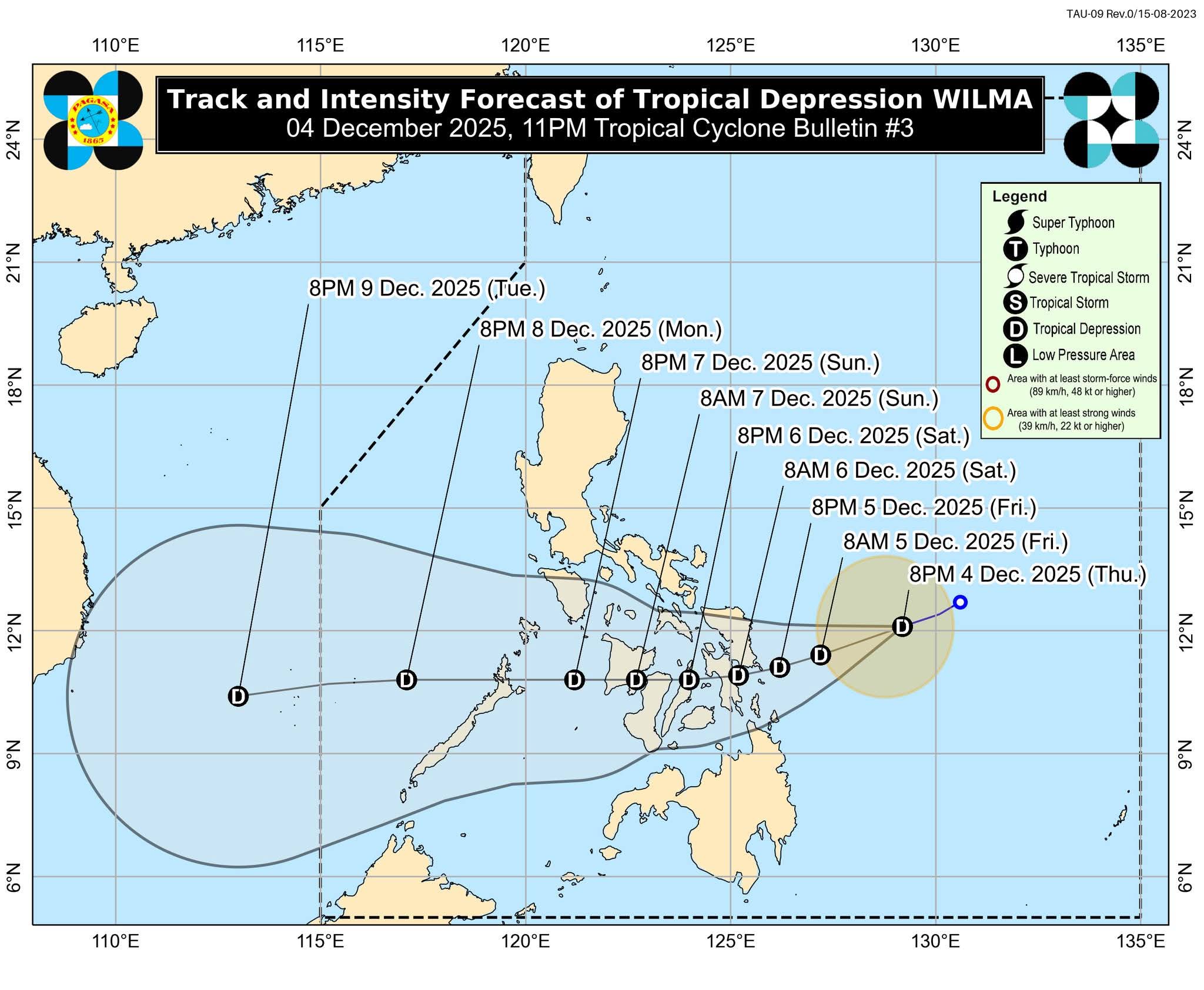
Tropical Depression Wilma maintained its strength Thursday night as it moved west-southwest over the Philippine Sea, Pagasa said in its 11 p.m. bulletin.
As of 10 p.m., the weather system was located 480 km east of Catarman, Northern Samar, packing maximum sustained winds of 45 kph and gusts of up to 55 kph. It was moving west-southwest at 15 kph, with strong winds extending up to 220 km from the center.
Bohol remains under Tropical Cyclone Wind Signal No. 1.
PAGASA warned that sea travel is risky due to rough to very rough sea conditions, with waves reaching up to 4 meters in affected eastern seaboards. Small vessels and motorbancas are advised to stay in port.
Wilma is expected to track west-southwest until Saturday before turning westward. It may make landfall in Eastern Visayas or Dinagat Islands between Friday evening and Saturday morning, then cross the Visayas until Sunday before emerging over the Sulu Sea and approaching northern Palawan.
The system may slightly intensify before landfall but is not expected to strengthen beyond a tropical depression while over land.