By I. Inojales | 09:40 AM February 04, 2026
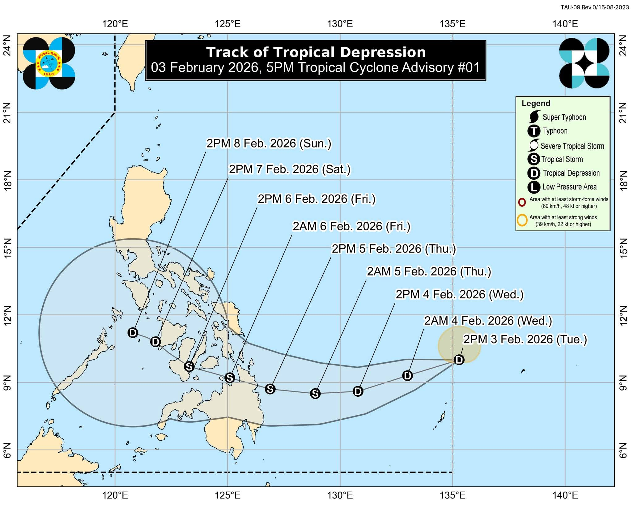
Tropical Depression Basyang is expected to pass near Bohol, traversing the southern portion of Cebu, at around 2 p.m. on Friday, February 6, 2026, according to the Philippine Atmospheric, Geophysical and Astronomical Services Administration (Pagasa).
A tropical depression is classified when maximum sustained winds are below 63 kilometers per hour, while a tropical storm has maximum sustained winds of 63 km/h or higher.
In its 5 a.m. bulletin, Pagasa said Basyang continues to move west-southwestward while maintaining its strength.
As of 4 a.m., the center of Basyang was located 895 kilometers east of Northeastern Mindanao, packing maximum sustained winds of 55 km/h and gusts of up to 70 km/h.
Tropical Cyclone Wind Signal No. 1 remains in effect over the southern portion of Surigao del Sur, where minimal to minor wind impacts are expected within the next 36 hours. Meanwhile, rough to very rough seas may pose risks to sea travel, particularly along several eastern seaboards.
Pagasa warned that Basyang may intensify into a tropical storm before making landfall over eastern Mindanao between Wednesday evening and Friday morning, and urged the public and local disaster management offices to take precautionary measures.