By I. Inojales | 07:48 AM November 03, 2025

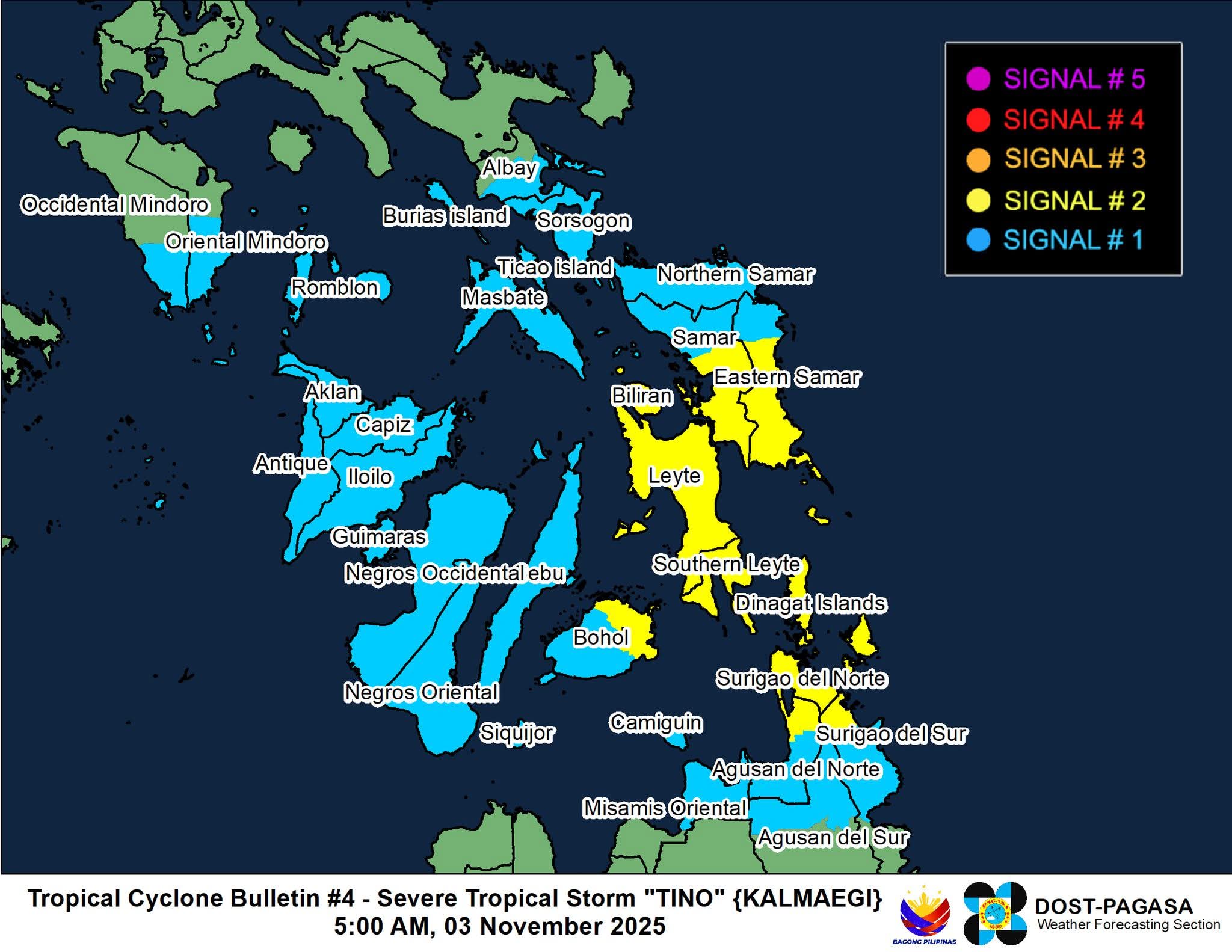
TAGBILARAN CITY – Eastern Bohol is now under Tropical Cyclone Wind Signal No. 2 as Severe Tropical Storm Tino (Kalmaegi) continues to intensify while moving west-southwest over the Philippine Sea early Monday, November 3.
In its 5 a. m. weather bulletin on Monday, Pagasa said Tino was last tracked 430 kilometers east of Guiuan, Eastern Samar, packing maximum sustained winds of 110 km/h and gusts of up to 135 km/h. It is forecast to make landfall over Eastern Samar, Leyte, or Dinagat Islands by late Monday night or early Tuesday morning.
Areas in eastern Bohol—including Talibon, Trinidad, Ubay, Bien Unido, Pres. Carlos P. Garcia, Mabini, Alicia, Candijay, Guindulman, Anda, San Miguel, Pilar, and Getafe—may experience gale-force winds and heavy rains within the next 24 hours.
Governor Aris Aumentado earlier ordered the suspension of classes in all levels on Monday as a precautionary measure. Disaster response teams across the province have been placed on full alert, particularly in flood- and landslide-prone areas.
Residents in coastal and low-lying communities are advised to remain vigilant and follow evacuation advisories from their local disaster officials.
Pagasa warned that Tino may intensify into a typhoon before landfall and could bring rough to very rough seas along the eastern seaboards of Bohol and nearby provinces.