By I. Inojales | 12:50 AM May 30, 2026

TAGBILARAN CITY — Tropical Storm “Domeng” intensified into a severe tropical storm on Friday night as state weather bureau Pagasa warned of strong winds and rough seas that may affect parts of the Visayas this weekend.
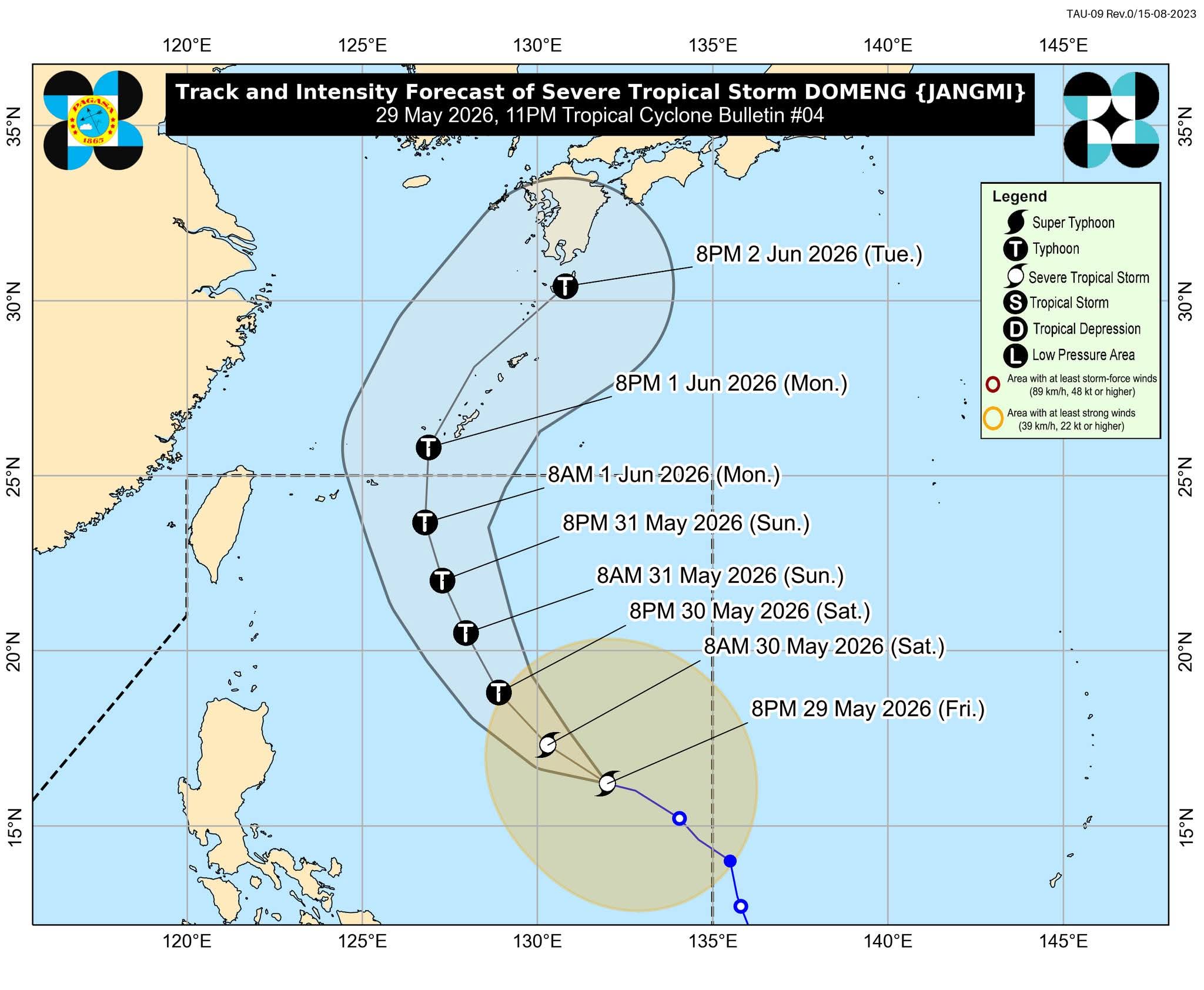
In its 11 p.m. bulletin, Pagasa said the center of Severe Tropical Storm Domeng was estimated at 1,045 kilometers east of Central Luzon, packing maximum sustained winds of 95 kilometers per hour near the center and gusts of up to 115 kph.
The storm was moving west northwestward at 15 kph.
No tropical cyclone wind signal had been hoisted as of late Friday, but Pagasa said the enhanced southwest monsoon or “habagat” caused by Domeng may bring heavy rains over the western portion of the country beginning Sunday, May 31.
The weather bureau added that strong to gale-force gusts may affect most parts of the Visayas on Saturday and Sunday, particularly in coastal and upland areas exposed to winds.
Pagasa also warned mariners and fishermen of moderate sea conditions in several coastal waters, including the southern seaboard of Bohol, where waves may reach up to two meters.
“Mariners of motorbancas and similarly sized vessels are advised to take precautionary measures while venturing out to sea and, if possible, avoid navigation under these conditions,” Pagasa said.
According to Pagasa, Domeng is expected to continue moving northwestward until Sunday before turning toward southern Japan.
The agency said the tropical cyclone is unlikely to make landfall in the Philippines and may exit the Philippine Area of Responsibility by Monday, June 1.
However, Pagasa said Domeng may further intensify and could reach typhoon category by Saturday evening while over the Philippine Sea.
Disaster risk reduction and management offices were advised to take precautionary measures and monitor weather updates, especially in areas vulnerable to heavy rains, strong winds, and rough seas.